
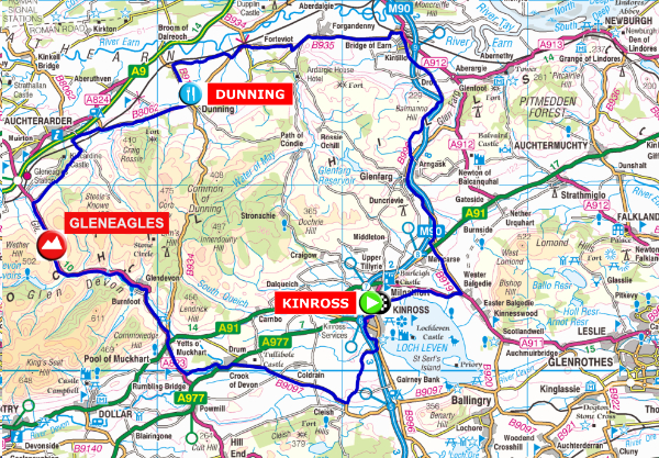
The Blue Route - 81 Km / 50.5 miles
|
The Blue route is 50.5 miles long and has a total ascent of 2473 feet
|
|


Contains Ordnance Survey data Crown copyright and database right 2018
click on the map for a detailed view
PLEASE NOTE: Due to a road closure for bridge repairs, you will now travel west after leaving Dunning, bypass Auchterarder to the south of the A9 and then join the Glen Eagles road towards the Yetts of Muckhart.
After leaving Kinross the route follows the Red and Black routes for a few miles before turning north to Glenfarg and then descending the steep and at times high speed Wicks ‘O Baiglie towards the Bridge of Earn. You then join the Red and Black routes again to Dunning with its 12th. Century church of St. Serf and the monument to Maggie Wall who was burnt here as witch in 1657. Legend also has it that St. Serf slayed a dragon here who was bothering the locals.
After leaving Dunning you will travel west and keeping south of Auchterarder. You will then join the Glen Eagles road and climb over the top and then down to the Yetts of Muckhart before returning to Kinross through the Crook of Devon.


